 무엇을 찾고 계세요?
KCI등재
六溪土城의 調査ㆍ硏究成果와 歷史的 價値 = Investigation & Research Results and Historical Value of Yukgye Earthen Fortress
-
저자
-
발행기관
-
학술지명
-
권호사항
-
발행연도
2022
-
작성언어
Korean
-
주제어
-
등재정보
KCI등재
-
자료형태
학술저널
-
수록면
5-60(56쪽)
-
KCI 피인용횟수
0
-
제공처
This article summarizes the archaeological achievements of Yukgye Earthen Fortress through surface surveys and excavation surveys. Then, it examines the current status, structure, and historical value of Yukgye Earthen Fortress by reviewing documents in the Joseon Dynasty and modern maps before and after the Japanese colonial period.
The natural environment of Yukgye Earthen Fortress consists of the alluvial plateau on the riverbank of meandering rivers, the cliffs formed along the Chugaryeong Tectonic Valley, the development of rapids due to the inflow of tributary streams, mountainous areas such as Mt.
Gamak and Mt. Papyeong in the south, and tributary rivers flowing to the north. It is believed that such a blessed environment acted as the cause of the formation of Yukgye Earthen Fortress and many fortress relics around it. In the Joseon Dynasty literature on Yukgye Earthen Fortress, the name Yukgye Toseong(六溪土城, meaning Yukgye Earthen Fortress) was used in the Jeokseonghyeon Eupji(積城縣邑誌, Journal of Jeokseong-hyeon) after it was mentioned in Gihaeng Musul Juhaenggi(記行戊戌舟行記) as Yukgye Goru(drum tower) by Misu Heo Mok in 1658. In a topographical map of 1914, "Yukgye Toseongji(六溪土城址, meaning the site of Yukgye Earthen Fortress)" was indicated. It was indicated as Yukgye Seong(六溪城 meaning Yukgye Castle) in a national forest boundary map of 1915. The fortress structure shows the three-layered plane: inner, outer, and baby castles.
Next, looking at its historical value, Yukgye Earthen Fortress condenses the appearance and development stages of the fortress and provides a junction point of earthen fortresses on flat ground and mountainous stone fortresses. Chiljung Fortress(Chiljungseong) at the rear also changed from an earthen fortress to a stone fortress during this period. Until the middle of the 7th century, Chiljung Fortress was a multi-layered earthen fortress. It was a double-layered fortress, like YukgyeEarthen Fortress. For example, in the Samguk Sagi(三國史記, History of the Three Kingdoms), Goguryeo's invasion of Chiljung Fortress in October and November of the same year, brilliant performances of Alcheon of Silla Kingdom, and Goguryeo's attack on Chiljungseong in November 660, and deaths of King and the ordinary people during the war occurred in theearthen fortresses with several layers. In addition, Horo Goru, known for stone structure with earthen axis along the Imjin River or stone fortress, Dangpo Fortress, Eundaeri Fortress, and Deokjin Mountain Fortress, also assumed to have natural structures of the earthen structure until this time.
In addition, as the only triple flat castle in Korea, Yukgye Earthen Fortress was the largest base fortress in the Baekje Hanseong Period in the Imjin River Basin. The best Goguryeo relics and relics in South Korea were excavated there. After that, a military defense system was established centered on Horogoru, Dangpo Fortress, Eundaeri Fortress, Ami Fortress, Durubong Fortress, and Taebongsan Fortress. In other words, the combination relationship of Yukgye Earthen Fortress + Chiljung Fortress + Mt. Gamak = flatland fortress + mountain fortress + high and stiff mountain was the basis for forming the ancient military defense system in the Imjin River basin.
So far, this study has tried to figure out the plane structure of the earthen fortress through the historical review of Yukgye Earthen Fortress. It provides a standard for examining the change process by period in the future. It is considered necessary to approach the fortresses with diverse perspectives with comprehension of natural topography and artificial structures such as rapids, cliffs, and mounds in the future.
이 글은 육계토성의 고고학적 성과를 지표조사와 발굴조사 등으로 나누어 정리한 후조선시대 문헌과 일제강점기 전후 근대 지도류 등의 검토를 통해 육계토성의 현황 및 구조 그리고 역사적 가치를 살펴본 것이다.
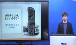
육계토성의 자연환경은 사행하천의 하안 충적대지, 추가령 구조곡을 따라 형성된 단애, 지류하천의 유입에 따른 나루와 여울의 발달, 남쪽의 감악산, 파평산 등 산간지대와북류하는 지류하천 등으로 요약된다. 이러한 천혜의 환경은 육계토성과 그 주변에 많은성곽유적을 잉태하는 원인으로 작용하였다고 여겨진다. 육계토성에 관한 조선시대 문헌은 1658년 미수 허목의 「記行戊戌舟行記」에 ‘六溪 古壘’라고 언급된 이후 『積城縣邑誌』 에서 ‘六溪土城’이라는 명칭을 사용하고 있다. 1914년 지형도에서는 ‘六溪土城址’, 1915 년 국유림 경계도에는 ‘六溪城’으로 표기하고 있다. 성의 구조는 성의 구조는 내성, 외성, 자성의 3중 성곽의 평면을 보여주고 있다.
다음으로 그 역사적 가치를 보면, 육계토성은 성의 출현과 발전단계를 응축하고 있으며 평지 토성과 산지 석성의 갈래를 제공하고 있다. 현재 배후의 칠중성 역시 이 시기를거치면서 토축성에서 석축성으로 변화하였으며 이전 7세기 중반까지도 육계토성과 마찬가지로 여러 겹의 토성 즉 重城이었다고 할 수 있다. 예컨대 『三國史記』에 나타난, 638년10월과 동년 11월에 벌어진 고구려의 칠중성 침입, 신라 알천의 활약, 660년 11월에 고구려의 칠중성 공격과 군주 필부 전사 등의 사건은 여러 겹의 土城에서 벌어졌다고 하겠다. 이외 임진강 변의 토심석축 혹은 석축성으로 알려진 호로고루, 당포성, 은대리성, 덕진산성 등도 이 시기까지는 토성의 景觀이 자연스럽지 않을까 한다.
또한 국내 유일의 3중 평지성으로 임진강 유역 백제 한성기의 최대 거점성에 해당된다. 그리고 남한내 최고의 고구려계 유구와 유물이 발굴되었으며 이후 호로고루와 당포성, 은대리성, 아미성, 두루봉보루, 태봉산보루 등을 위시하는 관방체계를 구축하게 된다. 즉 육계토성+칠중성+감악산=평지성+산성+고험처의 조합관계는 임진강유역의 고대 관방체계를 형성하는 모태가 된다고 할 수 있다.
지금까지 육계토성의 연구사적 검토를 통해 토성의 평면 구조를 파악해 보았는데 이는 향후 시기별 변천과정을 고찰하는데 하나의 기준을 제공하였다고 생각한다. 앞으로여울, 단애, 토루 등 자연 지형과 인공 구조물에 대한 다양한 관점과 이해를 가지고 성곽에 접근하는 자세가 필요하다고 여겨진다.
- 1 단국대학교 매장문화재연구소, "포천 반월산성 종합보고서" 2004
- 2 한양대학교박물관, "파주시의 역사와 문화유적" 1999
- 3 한양대학교박물관, "파주시 문화유적 분포지도" 1999
- 4 단국대학교 매장문화재연구소, "파주 칠중성 지표조사보고서" 2001
- 5 권도희, "파주 주월리유적 96-7호 주거지 출토 아궁이장식" 경기도박물관 7 : 2003
- 6 백제문화개발연구원, "파주 六溪土城 조사연구보고서" 2007
- 7 백종오, "중부지역 고대 성곽의 신발견" 한국고대학회 2020
- 8 김기섭, "종합고찰, 파주 六溪土城 조사연구보고서" 백제문화개발연구원 2007
- 9 이준선, "적성지역의 전략적 가치와 그 배경" 한국문화역사지리학회 16 (16): 1-18, 2004
- 10 이정빈, "임진강․한탄강 유역의 고구려 지명과 그 의미 - 경기도 연천 지역을 중심으로 -" 한국사학회 (134) : 39-68, 2019
- 11 崔楨苾, "임진강 주월리 유적지" 韓國上古史學會 23 : 1996
- 12 경기도박물관, "임진강" 2001
- 13 백종오, "인천 문학산성의 연구성과와 역사적 가치" 역사문화연구소 (76) : 3-42, 2020
- 14 경기도박물관, "우리 곁의 고구려" 2005
- 15 경기도박물관, "아미성ㆍ수철성" 2008
- 16 서영일, "신라 육상 교통로 연구" 학연문화사 1999
- 17 여호규, "삼국형성기 문헌사와 고고학의 접점" 한국상고사학회 100 (100): 109-136, 2018
- 18 경기도박물관, "비무장지대 도라산유적" 2003
- 19 박순발, "백제토기 탐구" 주류성 2006
- 20 金性泰, "백제초기의 인천, 고고학을 통해 본 백제초기의 인천" 2005
- 21 박순발, "백제, 마한과 하나되다" 한성백제박물관 2013
- 22 文安植, "백제 연맹왕국 형성기의 대중국군현관계 연구 : 韓·魏간의 무력충돌을 중심으로" 東國大學校 大學院 1996
- 23 이기환, "민통선 문화유산 기행(11) 파주 주월리 육계토성"
- 24 이기환, "민통선 문화유산 기행(10) 파주 주월리 육계토성"
- 25 경기도박물관, "묻혀진 백제문화로의 산책 한성백제" 2006
- 26 정호섭, "남한지역 고구려 유적 유물의 현황과 과제" 고구려연구재단 4 : 2005
- 27 국립문화재연구소, "남한의 고구려 유적 현황조사 및 보존정비 기본계획(안)" 2006
- 28 국립문화재연구소, "남한의 고구려 유적 현황조사 및 보존정비 기본계획(안)" 2006
- 29 임기환, "광개토왕비에 보이는 백제 관련 기사의 검토, 한성백제 사료연구" 경기문화재단 2005
- 30 경기도박물관, "고양 멱절산유적" 2005
- 31 정호섭, "고구려의 州․郡․縣에 대한 재검토- 중․후기 지방편제의 이해와 관련하여 -" 한국사학회 (133) : 5-46, 2019
- 32 백종오, "고구려 남진정책 연구" 서경문화사 2006
- 33 경기도박물관, "경기지역문화특별전 임진강" 2009
- 34 경기문화재단, "경기도의 성곽" 2003
- 35 경기도박물관, "경기도박물관 명품선" 2004
- 36 경기도박물관, "경기도 고인돌" 2007
- 37 하일식, "감악산비 논란과 감악신사에 대하여" 한국역사연구회 (117) : 485-518, 2020
- 38 尹武炳, "高句麗와 百濟의 城郭" 忠南大學校 百濟硏究所 1993
- 39 백종오, "高句麗遺蹟의 寶庫 京畿道" 경기도박물관 2005
- 40 경기도박물관, "高句麗 遺蹟의 寶庫 京畿道" 2005
- 41 백종오, "高句麗 城郭 築城術의 擴散에 대한 豫備的 檢討" 고구려발해학회 59 : 205-244, 2017
- 42 신희권, "風納土城 발굴조사를 통한 河南慰禮城 고찰" 서울특별시사편찬위원회 62 : 2002
- 43 신희권, "風納土城 築造年代 試論" 한국상고사학회 37 : 29-51, 2002
- 44 한국보이스카우트연맹, "韓國의 城郭과 烽燧 上" 1989
- 45 국립문화재연구소, "韓國考古學專門事典 城郭 烽燧篇" 2011
- 46 "輿地圖書"
- 47 국립문화재연구소, "軍事保護區域 文化遺蹟 地表調査報告書 江原道篇" 2000
- 48 국립문화재연구소, "軍事保護區域 文化遺蹟 地表調査報告書 京畿道篇" 2000
- 49 "記言別集"
- 50 李宰, "臨津江 流域의 軍事遺蹟 地表調査報告" 3 : 1993
- 51 백종오, "臨津江 南岸一帶의 關防遺蹟" 경기도박물관 2 : 2001
- 52 李龍範, "紺岳山 古碑에 대하여" 동국대학교 박물관 7 : 1983
- 53 "積城縣邑誌"
- 54 홍재선, "積城 七重城 調査略報" 동국대학교 박물관 7 : 1983
- 55 한준영, "百濟 漢城期의 城郭出土 土器 硏究" 韓國古代學會 18 : 2003
- 56 백종오, "百濟 漢城期 六溪土城에 대하여" 국립공주박물관 5 : 2006
- 57 경기도박물관, "漣川 三巨里遺蹟" 2002
- 58 朴淳發, "漢城百濟의 誕生" 2001
- 59 朝鮮總督府, "朝鮮寶物古蹟調査資料" 1942
- 60 경기도박물관, "月籠山城" 2005
- 61 尹星鎬, "新羅의 漢江流域 領域化 過程 硏究" 高麗大學校 2017
- 62 문화공보부 문화재관리국, "文化遺蹟總覽" 1978
- 63 경기도박물관, "抱川 自作里遺蹟" 2004
- 64 경기도박물관, "抱川 城東里마을遺蹟" 1999
- 65 백종오, "抱川 城東里山城의 變遷過程 檢討" 韓國古代學會 20 : 2004
- 66 "大東地志"
- 67 京畿道博物館, "坡州 舟月里遺蹟" 1999
- 68 경기도박물관, "坡州 月籠山城" 2003
- 69 京畿道博物館, "坡州 六溪土城" 2006
- 70 백종오, "南韓地域 高句麗 關防體系 - 臨津江流域을 중심으로 -" 한국고대학회 (26) : 279-306, 2007
- 71 경기도박물관, "南北連結道路(統一大橋~長湍間) 文化遺蹟 試掘調査 報告書" 2001
- 72 김성태, "北漢山城 연구논문집" 경기문화재단 경기학연구센터 2016
- 73 문화공보부 문화재관리국, "全國遺蹟目錄" 1970
- 74 경기도박물관, "京義線 連結道路 非武裝地帶區間 文化遺蹟 地表調査 報告書" 2003
- 75 백종오, "京畿道의 城郭" 경기문화재단 2003
- 76 陸軍士官學校 陸軍博物館, "京畿道 坡州郡 軍事遺蹟 地表調査 報告書" 1994
- 77 경기도박물관, "京畿文化遺蹟地圖" 2001
- 78 김기섭, "京畿地域의 鄕土文化 下" 韓國精神文化硏究院 1997
- 79 韓國精神文化硏究院, "京畿地域의 鄕土文化" 1997
- 80 백종오, "中國內 高句麗山城의 發掘 現況과 主要 遺構·遺物의 檢討 -2005年∼2016年 發掘調査를 중심으로-" 한국고대학회 (53) : 5-48, 2017
- 81 尹龍九, "三韓의 對中交涉과 그 性格" 국사편찬위원회 85 : 1999
- 82 "三國史記"
- 83 오오타 히데하루, "『朝鮮城址實測圖』와 倭城 -朝鮮總督府의 植民地 支配와 관련하여-" 규장각한국학연구원 (25) : 135-191, 2000
- 84 윤성호, "『朝鮮城址實測圖』를 활용한 삼국시대 성곽 연구" 고려사학회 (83) : 131-160, 2021
- 85 京畿道博物館, "’97京畿道博物館 發掘調査槪報" 1997
- 86 백종오, "6세기 중반 신라 丹陽 赤城의 景觀" 한국고대학회 (61) : 5-27, 2019
- 87 장창은, "660~662년 고구려와 신라・당의 전쟁" 신라사학회 (38) : 65-113, 2016
- 88 황보경, "603년 北漢山城 전투 고찰" 고려사학회 (58) : 33-64, 2015
- 89 여호규, "5세기 후반~6세기 중엽 高句麗와 百濟의 국경 변천" 백제문화연구소 1 (1): 129-152, 2013
- 90 여호규, "4세기 후반~5세기 초엽 고구려(高句麗)와 백제(百濟)의 국경 변천" 한국역사연구회 (84) : 169-213, 2012
- 91 백종오, "21세기의 한국고고학Ⅱ" 주류성 2009
동일학술지(권/호) 다른 논문

-
육계토성의 보존ㆍ정비 및 활용방안
- 한국고대학회
- 이종찬
- 2022
- KCI등재
-
DMZ 내 유적 탐색과 신발견
- 한국고대학회
- 허의행
- 2022
- KCI등재
-
강동구 서부지역의 고지형 연구
- 한국고대학회
- 이성호
- 2022
- KCI등재
-
철제 가위의 변천양상 연구
- 한국고대학회
- 이민규
- 2022
- KCI등재
분석정보
- 학술지 이력
학술지 이력 연월일 이력구분 이력상세 등재구분 2027 평가예정 재인증평가 신청대상 (재인증) 2021-01-01 평가 등재학술지 유지 (재인증) KCI등재 2018-01-01 평가 등재학술지 유지 (등재유지) KCI등재 2015-01-01 평가 등재학술지 유지 (등재유지) KCI등재 2011-01-01 평가 등재학술지 유지 (등재유지) KCI등재 2008-01-01 평가 등재학술지 선정 (등재후보2차) KCI등재 2007-01-01 평가 등재후보 1차 PASS (등재후보1차) KCI후보 2005-01-01 평가 등재후보학술지 선정 (신규평가) KCI후보 - 학술지 인용정보
학술지 인용정보 기준연도 WOS-KCI 통합IF(2년) KCIF(2년) KCIF(3년) 2016 0.59 0.59 0.61 KCIF(4년) KCIF(5년) 중심성지수(3년) 즉시성지수 0.59 0.56 1.438 0.17
서지정보 내보내기(Export)
닫기소장기관 정보
닫기권호소장정보
닫기오류접수
닫기오류 접수 확인
닫기음성서비스 신청
닫기음성서비스 신청 확인
닫기이용약관
닫기학술연구정보서비스 이용약관 (2017년 1월 1일 ~ 현재 적용)
-
제 1 장 총칙
-
제 1 조 (목적)
- 이 약관은 한국교육학술정보원(이하 "교육정보원"라 함)이 제공하는 학술연구정보서비스의 웹사이트(이하 "서비스" 라함)의 이용에 관한 조건 및 절차와 기타 필요한 사항을 규정하는 것을 목적으로 합니다.
-
제 2 조 (약관의 효력과 변경)
- ① 이 약관은 서비스 메뉴에 게시하여 공시함으로써 효력을 발생합니다.
- ② 교육정보원은 합리적 사유가 발생한 경우에는 이 약관을 변경할 수 있으며, 약관을 변경한 경우에는 지체없이 "공지사항"을 통해 공시합니다.
- ③ 이용자는 변경된 약관사항에 동의하지 않으면, 언제나 서비스 이용을 중단하고 이용계약을 해지할 수 있습니다.
-
제 3 조 (약관외 준칙)
- 이 약관에 명시되지 않은 사항은 관계 법령에 규정 되어있을 경우 그 규정에 따르며, 그렇지 않은 경우에는 일반적인 관례에 따릅니다.
-
제 4 조 (용어의 정의)
이 약관에서 사용하는 용어의 정의는 다음과 같습니다.- ① 이용자 : 교육정보원과 이용계약을 체결한 자
- ② 이용자번호(ID) : 이용자 식별과 이용자의 서비스 이용을 위하여 이용계약 체결시 이용자의 선택에 의하여 교육정보원이 부여하는 문자와 숫자의 조합
- ③ 비밀번호 : 이용자 자신의 비밀을 보호하기 위하여 이용자 자신이 설정한 문자와 숫자의 조합
- ④ 단말기 : 서비스 제공을 받기 위해 이용자가 설치한 개인용 컴퓨터 및 모뎀 등의 기기
- ⑤ 서비스 이용 : 이용자가 단말기를 이용하여 교육정보원의 주전산기에 접속하여 교육정보원이 제공하는 정보를 이용하는 것
- ⑥ 이용계약 : 서비스를 제공받기 위하여 이 약관으로 교육정보원과 이용자간의 체결하는 계약을 말함
- ⑦ 마일리지 : RISS 서비스 중 마일리지 적립 가능한 서비스를 이용한 이용자에게 지급되며, RISS가 제공하는 특정 디지털 콘텐츠를 구입하는 데 사용하도록 만들어진 포인트
-
-
제 2 장 서비스 이용 계약
-
제 5 조 (이용계약의 성립)
- ① 이용계약은 이용자의 이용신청에 대한 교육정보원의 이용 승낙에 의하여 성립됩니다.
- ② 제 1항의 규정에 의해 이용자가 이용 신청을 할 때에는 교육정보원이 이용자 관리시 필요로 하는
사항을 전자적방식(교육정보원의 컴퓨터 등 정보처리 장치에 접속하여 데이터를 입력하는 것을 말합니다)
이나 서면으로 하여야 합니다. - ③ 이용계약은 이용자번호 단위로 체결하며, 체결단위는 1 이용자번호 이상이어야 합니다.
- ④ 서비스의 대량이용 등 특별한 서비스 이용에 관한 계약은 별도의 계약으로 합니다.
-
제 6 조 (이용신청)
- ① 서비스를 이용하고자 하는 자는 교육정보원이 지정한 양식에 따라 온라인신청을 이용하여 가입 신청을 해야 합니다.
- ② 이용신청자가 14세 미만인자일 경우에는 친권자(부모, 법정대리인 등)의 동의를 얻어 이용신청을 하여야 합니다.
-
제 7 조 (이용계약 승낙의 유보)
- ① 교육정보원은 다음 각 호에 해당하는 경우에는 이용계약의 승낙을 유보할 수 있습니다.
- 1. 설비에 여유가 없는 경우
- 2. 기술상에 지장이 있는 경우
- 3. 이용계약을 신청한 사람이 14세 미만인 자로 친권자의 동의를 득하지 않았을 경우
- 4. 기타 교육정보원이 서비스의 효율적인 운영 등을 위하여 필요하다고 인정되는 경우
- ② 교육정보원은 다음 각 호에 해당하는 이용계약 신청에 대하여는 이를 거절할 수 있습니다.
- 1. 다른 사람의 명의를 사용하여 이용신청을 하였을 때
- 2. 이용계약 신청서의 내용을 허위로 기재하였을 때
- ① 교육정보원은 다음 각 호에 해당하는 경우에는 이용계약의 승낙을 유보할 수 있습니다.
-
제 8 조 (계약사항의 변경)
이용자는 다음 사항을 변경하고자 하는 경우 서비스에 접속하여 서비스 내의 기능을 이용하여 변경할 수 있습니다.- ① 성명 및 생년월일, 신분, 이메일
- ② 비밀번호
- ③ 자료신청 / 기관회원서비스 권한설정을 위한 이용자정보
- ④ 전화번호 등 개인 연락처
- ⑤ 기타 교육정보원이 인정하는 경미한 사항
-
-
제 3 장 서비스의 이용
-
제 9 조 (서비스 이용시간)
- 서비스의 이용 시간은 교육정보원의 업무 및 기술상 특별한 지장이 없는 한 연중무휴, 1일 24시간(00:00-24:00)을 원칙으로 합니다. 다만 정기점검등의 필요로 교육정보원이 정한 날이나 시간은 그러하지 아니합니다.
-
제 10 조 (이용자번호 등)
- ① 이용자번호 및 비밀번호에 대한 모든 관리책임은 이용자에게 있습니다.
- ② 명백한 사유가 있는 경우를 제외하고는 이용자가 이용자번호를 공유, 양도 또는 변경할 수 없습니다.
- ③ 이용자에게 부여된 이용자번호에 의하여 발생되는 서비스 이용상의 과실 또는 제3자에 의한 부정사용 등에 대한 모든 책임은 이용자에게 있습니다.
-
제 11 조 (서비스 이용의 제한 및 이용계약의 해지)
- ① 이용자가 서비스 이용계약을 해지하고자 하는 때에는 온라인으로 교육정보원에 해지신청을 하여야 합니다.
- ② 교육정보원은 이용자가 다음 각 호에 해당하는 경우 사전통지 없이 이용계약을 해지하거나 전부 또는 일부의 서비스 제공을 중지할 수 있습니다.
- 1. 타인의 이용자번호를 사용한 경우
- 2. 다량의 정보를 전송하여 서비스의 안정적 운영을 방해하는 경우
- 3. 수신자의 의사에 반하는 광고성 정보, 전자우편을 전송하는 경우
- 4. 정보통신설비의 오작동이나 정보 등의 파괴를 유발하는 컴퓨터 바이러스 프로그램등을 유포하는 경우
- 5. 정보통신윤리위원회로부터의 이용제한 요구 대상인 경우
- 6. 선거관리위원회의 유권해석 상의 불법선거운동을 하는 경우
- 7. 서비스를 이용하여 얻은 정보를 교육정보원의 동의 없이 상업적으로 이용하는 경우
- 8. 비실명 이용자번호로 가입되어 있는 경우
- 9. 일정기간 이상 서비스에 로그인하지 않거나 개인정보 수집․이용에 대한 재동의를 하지 않은 경우
- ③ 전항의 규정에 의하여 이용자의 이용을 제한하는 경우와 제한의 종류 및 기간 등 구체적인 기준은 교육정보원의 공지, 서비스 이용안내, 개인정보처리방침 등에서 별도로 정하는 바에 의합니다.
- ④ 해지 처리된 이용자의 정보는 법령의 규정에 의하여 보존할 필요성이 있는 경우를 제외하고 지체 없이 파기합니다.
- ⑤ 해지 처리된 이용자번호의 경우, 재사용이 불가능합니다.
-
제 12 조 (이용자 게시물의 삭제 및 서비스 이용 제한)
- ① 교육정보원은 서비스용 설비의 용량에 여유가 없다고 판단되는 경우 필요에 따라 이용자가 게재 또는 등록한 내용물을 삭제할 수 있습니다.
- ② 교육정보원은 서비스용 설비의 용량에 여유가 없다고 판단되는 경우 이용자의 서비스 이용을 부분적으로 제한할 수 있습니다.
- ③ 제 1 항 및 제 2 항의 경우에는 당해 사항을 사전에 온라인을 통해서 공지합니다.
- ④ 교육정보원은 이용자가 게재 또는 등록하는 서비스내의 내용물이 다음 각호에 해당한다고 판단되는 경우에 이용자에게 사전 통지 없이 삭제할 수 있습니다.
- 1. 다른 이용자 또는 제 3자를 비방하거나 중상모략으로 명예를 손상시키는 경우
- 2. 공공질서 및 미풍양속에 위반되는 내용의 정보, 문장, 도형 등을 유포하는 경우
- 3. 반국가적, 반사회적, 범죄적 행위와 결부된다고 판단되는 경우
- 4. 다른 이용자 또는 제3자의 저작권 등 기타 권리를 침해하는 경우
- 5. 게시 기간이 규정된 기간을 초과한 경우
- 6. 이용자의 조작 미숙이나 광고목적으로 동일한 내용의 게시물을 10회 이상 반복하여 등록하였을 경우
- 7. 기타 관계 법령에 위배된다고 판단되는 경우
-
제 13 조 (서비스 제공의 중지 및 제한)
- ① 교육정보원은 다음 각 호에 해당하는 경우 서비스 제공을 중지할 수 있습니다.
- 1. 서비스용 설비의 보수 또는 공사로 인한 부득이한 경우
- 2. 전기통신사업법에 규정된 기간통신사업자가 전기통신 서비스를 중지했을 때
- ② 교육정보원은 국가비상사태, 서비스 설비의 장애 또는 서비스 이용의 폭주 등으로 서비스 이용에 지장이 있는 때에는 서비스 제공을 중지하거나 제한할 수 있습니다.
- ① 교육정보원은 다음 각 호에 해당하는 경우 서비스 제공을 중지할 수 있습니다.
-
제 14 조 (교육정보원의 의무)
- ① 교육정보원은 교육정보원에 설치된 서비스용 설비를 지속적이고 안정적인 서비스 제공에 적합하도록 유지하여야 하며 서비스용 설비에 장애가 발생하거나 또는 그 설비가 못쓰게 된 경우 그 설비를 수리하거나 복구합니다.
- ② 교육정보원은 서비스 내용의 변경 또는 추가사항이 있는 경우 그 사항을 온라인을 통해 서비스 화면에 공지합니다.
-
제 15 조 (개인정보보호)
- ① 교육정보원은 공공기관의 개인정보보호에 관한 법률, 정보통신이용촉진등에 관한 법률 등 관계법령에 따라 이용신청시 제공받는 이용자의 개인정보 및 서비스 이용중 생성되는 개인정보를 보호하여야 합니다.
- ② 교육정보원의 개인정보보호에 관한 관리책임자는 학술연구정보서비스 이용자 관리담당 부서장(학술정보본부)이며, 주소 및 연락처는 대구광역시 동구 동내로 64(동내동 1119) KERIS빌딩, 전화번호 054-714-0114번, 전자메일 privacy@keris.or.kr 입니다. 개인정보 관리책임자의 성명은 별도로 공지하거나 서비스 안내에 게시합니다.
- ③ 교육정보원은 개인정보를 이용고객의 별도의 동의 없이 제3자에게 제공하지 않습니다. 다만, 다음 각 호의 경우는 이용고객의 별도 동의 없이 제3자에게 이용 고객의 개인정보를 제공할 수 있습니다.
- 1. 수사상의 목적에 따른 수사기관의 서면 요구가 있는 경우에 수사협조의 목적으로 국가 수사 기관에 성명, 주소 등 신상정보를 제공하는 경우
- 2. 신용정보의 이용 및 보호에 관한 법률, 전기통신관련법률 등 법률에 특별한 규정이 있는 경우
- 3. 통계작성, 학술연구 또는 시장조사를 위하여 필요한 경우로서 특정 개인을 식별할 수 없는 형태로 제공하는 경우
- ④ 이용자는 언제나 자신의 개인정보를 열람할 수 있으며, 스스로 오류를 수정할 수 있습니다. 열람 및 수정은 원칙적으로 이용신청과 동일한 방법으로 하며, 자세한 방법은 공지, 이용안내에 정한 바에 따릅니다.
- ⑤ 이용자는 언제나 이용계약을 해지함으로써 개인정보의 수집 및 이용에 대한 동의, 목적 외 사용에 대한 별도 동의, 제3자 제공에 대한 별도 동의를 철회할 수 있습니다. 해지의 방법은 이 약관에서 별도로 규정한 바에 따릅니다.
-
제 16 조 (이용자의 의무)
- ① 이용자는 서비스를 이용할 때 다음 각 호의 행위를 하지 않아야 합니다.
- 1. 다른 이용자의 이용자번호를 부정하게 사용하는 행위
- 2. 서비스를 이용하여 얻은 정보를 교육정보원의 사전승낙없이 이용자의 이용이외의 목적으로 복제하거나 이를 출판, 방송 등에 사용하거나 제3자에게 제공하는 행위
- 3. 다른 이용자 또는 제3자를 비방하거나 중상모략으로 명예를 손상하는 행위
- 4. 공공질서 및 미풍양속에 위배되는 내용의 정보, 문장, 도형 등을 타인에게 유포하는 행위
- 5. 반국가적, 반사회적, 범죄적 행위와 결부된다고 판단되는 행위
- 6. 다른 이용자 또는 제3자의 저작권등 기타 권리를 침해하는 행위
- 7. 기타 관계 법령에 위배되는 행위
- ② 이용자는 이 약관에서 규정하는 사항과 서비스 이용안내 또는 주의사항을 준수하여야 합니다.
- ③ 이용자가 설치하는 단말기 등은 전기통신설비의 기술기준에 관한 규칙이 정하는 기준에 적합하여야 하며, 서비스에 장애를 주지 않아야 합니다.
- ① 이용자는 서비스를 이용할 때 다음 각 호의 행위를 하지 않아야 합니다.
-
제 17 조 (광고의 게재)
교육정보원은 서비스의 운용과 관련하여 서비스화면, 홈페이지, 전자우편 등에 광고 등을 게재할 수 있습니다.
-
-
제 4 장 서비스 이용 요금
-
제 18 조 (이용요금)
- ① 서비스 이용료는 기본적으로 무료로 합니다. 단, 민간업체와의 협약에 의해 RISS를 통해 서비스 되는 콘텐츠의 경우 각 민간 업체의 요금 정책에 따라 유료로 서비스 합니다.
- ② 그 외 교육정보원의 정책에 따라 이용 요금 정책이 변경될 경우에는 온라인으로 서비스 화면에 게시합니다.
-
-
제 5 장 마일리지 정책
-
제 19 조 (마일리지 정책의 변경)
- ① RISS 마일리지는 2017년 1월부로 모두 소멸되었습니다.
- ② 교육정보원은 마일리지 적립ㆍ사용ㆍ소멸 등 정책의 변경에 대해 온라인상에 공지해야하며, 최근에 온라인에 등재된 내용이 이전의 모든 규정과 조건보다 우선합니다.
-
-
제 6 장 저작권
-
제 20 조 (게재된 자료에 대한 권리)
서비스에 게재된 자료에 대한 권리는 다음 각 호와 같습니다.- ① 게시물에 대한 권리와 책임은 게시자에게 있으며, 교육정보원은 게시자의 동의 없이는 이를 영리적 목적으로 사용할 수 없습니다.
- ② 게시자의 사전 동의가 없이는 이용자는 서비스를 이용하여 얻은 정보를 가공, 판매하는 행위 등 서비스에 게재된 자료를 상업적 목적으로 이용할 수 없습니다.
-
-
제 7 장 이의 신청 및 손해배상 청구 금지
-
제 21 조 (이의신청금지)
이용자는 교육정보원에서 제공하는 서비스 이용시 발생되는 어떠한 문제에 대해서도 무료 이용 기간 동안은 이의 신청 및 민원을 제기할 수 없습니다. -
제 22 조 (손해배상청구금지)
이용자는 교육정보원에서 제공하는 서비스 이용시 발생되는 어떠한 문제에 대해서도 무료 이용 기간 동안은 교육정보원 및 관계 기관에 손해배상 청구를 할 수 없으며 교육정보원은 이에 대해 책임을 지지 아니합니다.
-
-
부칙
이 약관은 2000년 6월 1일부터 시행합니다. -
부칙(개정 2005. 5. 31)
이 약관은 2005년 5월 31일부터 시행합니다. -
부칙(개정 2010. 1. 1)
이 약관은 2010년 1월 1일부터 시행합니다. -
부칙(개정 2010. 4 1)
이 약관은 2010년 4월 1일부터 시행합니다. -
부칙(개정 2017. 1 1)
이 약관은 2017년 1월 1일부터 시행합니다.
학술연구정보서비스(이하 RISS)는 정보주체의 자유와 권리 보호를 위해 「개인정보 보호법」 및 관계 법령이 정한 바를 준수하여, 적법하게 개인정보를 처리하고 안전하게 관리하고 있습니다. 이에 「개인정보 보호법」 제30조에 따라 정보주체에게 개인정보 처리에 관한 절차 및 기준을 안내하고, 이와 관련한 고충을 신속하고 원활하게 처리할 수 있도록 하기 위하여 다음과 같이 개인정보 처리방침을 수립·공개합니다.
주요 개인정보 처리 표시(라벨링)
목 차
-
 제1조(개인정보의 처리 목적)
-
 제2조(개인정보의 처리 및 보유 기간)
-
 제3조(처리하는 개인정보의 항목)
-
 제4조(개인정보파일 등록 현황)
-
 제5조(개인정보의 제3자 제공)
-
 제6조(개인정보 처리업무의 위탁)
-
 제7조(개인정보의 파기 절차 및 방법)
-
 제8조(정보주체와 법정대리인의 권리·의무 및 그 행사 방법)
-
 제9조(개인정보의 안전성 확보조치)
-
 제10조(개인정보 자동 수집 장치의 설치·운영 및 거부)
-
 제11조(개인정보 보호책임자)
-
 제12조(개인정보의 열람청구를 접수·처리하는 부서)
-
 제13조(정보주체의 권익침해에 대한 구제방법)
-
 제14조(추가적 이용·제공 판단기준)
-
 제15조(개인정보 처리방침의 변경)
-
제1조(개인정보의 처리 목적)
- RISS는 개인정보를 다음의 목적을 위해 처리합니다. 처리하고 있는 개인정보는 다음의 목적 이외의 용도로는 이용되지 않으며, 이용 목적이 변경되는 경우에는 「개인정보 보호법」 제18조에 따라 별도의 동의를 받는 등 필요한 조치를 이행할 예정입니다.
-
가. 서비스 제공
- 콘텐츠 제공, 문헌배송 및 결제, 요금정산 등 서비스 제공
나. 회원관리
- 회원제 서비스 이용에 따른 본인확인,
- 만14세 미만 아동 개인 정보 수집 시 법정 대리인 동의여부 확인, 추후 법정 대리인 본인확인
- 분쟁 조정을 위한 기록보존, 불만처리 등을 위한 원활한 의사소통 경로의 확보, 공지사항 전달
다. 서비스 개선
- 신규 서비스 개발 및 특화
- 통계학적 특성에 따른 서비스 제공 및 광고 게재, 이벤트 등 정보 전달 및 참여 기회 제공
- 서비스 이용에 대한 통계 -
제2조(개인정보의 처리 및 보유 기간)
-
가. 처리기간 및 보유 기간:
3년
또는 회원탈퇴시까지
나. 다만, 다음의 사유에 해당하는 경우에는 해당 사유 종료시 까지 정보를 보유 및 열람합니다.
▶ 신청 중인 서비스가 완료 되지 않은 경우
- 보존 이유 : 진행 중인 서비스 완료(예:원문복사 등)
- 보존 기간 : 서비스 완료 시까지
- 열람 예정 시기 : 수시(RISS에서 신청된 서비스의 처리내역 및 진행상태 확인 요청 시)
▶ 관련법령에 의한 정보보유 사유 및 기간
- 대금결제 및 재화 등의 공급에 관한 기록 :5년
(「전자상거래 등에서의 소비자보호에 관한
법률」 제 6조 및 시행령 제 6조)
- 소비자의 불만 또는 분쟁 처리에 관한 기록 :3년
(「전자상거래 등에서의 소비자보호에 관한
법률」 제 6조 및 시행령 제 6조)
- 접속에 관한 기록 :2년
이상(개인정보보호위원회 : 개인정보의 안전성 확보조치 기준) -
제3조(처리하는 개인정보의 항목)
-
가. 필수 항목 : ID, 이름, 생년월일, 신분(직업구분), 이메일, 소속분야,
보호자 성명(어린이회원), 보호자 이메일(어린이회원)
나: 선택 항목 : 소속기관명, 학과/부서명, 학번/직원번호, 전화, 주소, 장애인 여부
다. 자동수집항목 : IP주소, ID, 서비스 이용기록, 방문기록 -
제4조(개인정보파일 등록 현황)
-
개인정보파일의 명칭 운영근거 / 처리목적 개인정보파일에 기록되는 개인정보의 항목 보유기간 학술연구정보서비스 이용자 가입정보 파일 한국교육학술정보원법 필수 ID, 비밀번호, 성명, 생년월일, 신분(직업구분), 이메일, 소속분야, 웹진메일 수신동의 여부 3년
또는
탈퇴시선택 소속기관명, 소속도서관명, 학과/부서명, 학번/직원번호, 휴대전화, 주소 -
제5조(개인정보의 제3자 제공)
-
가. RISS는 원칙적으로 정보주체의 개인정보를 제1조(개인정보의 처리 목적)에서 명시한 범위 내에서
처리하며, 정보주체의 사전 동의 없이는 본래의 범위를 초과하여 처리하거나 제3자에게 제공하지
않습니다. 단, 정보주체의 동의, 법률의 특별한 규정 등 개인정보 보호법 제17조 및 제18조에 해당하는
경우에만 개인정보를 제3자에게 제공합니다.
나. RISS는 원활한 서비스 제공을 위해 다음의 경우 정보주체의 동의를 얻어 필요 최소한의 범위로만
제공합니다.
- 복사/대출 배송 서비스를 위해서 아래와 같이 개인정보를 제공합니다.
1. 개인정보 제공 대상 : 제공도서관, ㈜이니시스(선불결제 시)
2. 개인정보 제공 목적 : 복사/대출 서비스 제공
3. 개인정보 제공 항목 : 이름, 전화번호, 이메일
4. 개인정보 보유 및 이용 기간 : 신청건 발생일 후 5년
▶ 개인정보 제공에 동의하지 않을 권리가 있으며, 거부하는 경우 서비스 이용이 불가합니다. -
제6조(개인정보 처리업무의 위탁)
- RISS는 원활한 개인정보 업무처리를 위하여 다음과 같이 개인정보 처리업무를 위탁하고 있습니다.
-
가. 위탁하는 업무 내용 : 회원 개인정보 처리
나. 수탁업체명 : ㈜퓨쳐누리 - RISS는 위탁계약 체결 시 「개인정보 보호법」 제26조에 따라 위탁업무 수행 목적 외 개인정보 처리금지, 안전성 확보조치, 재위탁 제한, 수탁자에 대한 관리·감독, 손해배상 등 책임에 관한 사항을 계약서 등 문서에 명시하고, 수탁자가 개인정보를 안전하게 처리하는지를 감독하고 있습니다.
- 위탁업무의 내용이나 수탁자가 변경될 경우에는 지체 없이 본 개인정보 처리방침을 통하여 공개하도록 하겠습니다.
-
제7조(개인정보의 파기 절차 및 방법)
-
가. 파기절차
- 개인정보의 파기 : 보유기간이 경과한 개인정보는 종료일로부터 지체 없이 파기
- 개인정보파일의 파기 : 개인정보파일의 처리 목적 달성, 해당 서비스의 폐지, 사업의 종료 등 그
개인정보파일이 불필요하게 되었을 때에는 개인정보의 처리가 불필요한 것으로 인정되는 날로부터
지체 없이 그 개인정보파일을 파기.
나. 파기방법
- 전자적 형태의 정보는 기록을 재생할 수 없는 기술적 방법을 사용하여 파기.
- 종이에 출력된 개인정보는 분쇄기로 분쇄하거나 소각을 통하여 파기. -
제8조(정보주체와 법정대리인의 권리·의무 및 그 행사 방법)
-
정보주체(만 14세 미만인 경우에는 법정대리인을 말함)는 개인정보주체로서 다음과 같은 권리를 행사할 수 있습니다.
가. 권리 행사 항목 및 방법
- 권리 행사 항목: 개인정보 열람 요구, 오류 정정 요구, 삭제 요구, 처리정지 요구
- 권리 행사 방법: 개인정보 처리 방법에 관한 고시 별지 제8호(대리인의 경우 제11호) 서식에 따라
작성 후 서면, 전자우편, 모사전송(FAX), 전화, 인터넷(홈페이지 고객센터) 제출
나. 개인정보 열람 및 처리정지 요구는 「개인정보 보호법」 제35조 제5항, 제37조 제2항에 의하여
정보주체의 권리가 제한 될 수 있음
다. 개인정보의 정정 및 삭제 요구는 다른 법령에서 그 개인정보가 수집 대상으로 명시되어 있는 경우에는
그 삭제를 요구할 수 없음
라. RISS는 정보주체 권리에 따른 열람의 요구, 정정·삭제의 요구, 처리정지의 요구 시
열람 등 요구를 한 자가 본인이거나 정당한 대리인인지를 확인함.
마. 정보주체의 권리행사 요구 거절 시 불복을 위한 이의제기 절차는 다음과 같습니다.
1) 해당 부서에서 열람 등 요구에 대한 연기 또는 거절 시 요구 받은 날로부터 10일 이내에 정당한 사유
및 이의제기 방법 등을 통지
2) 해당 부서에서 정보주체의 이의제기 신청 및 접수(서면, 유선, 이메일 등)하여 개인정보보호 담당자가
내용 확인
3) 개인정보관리책임자가 처리결과에 대한 최종 검토
4) 해당부서에서 정보주체에게 처리결과 통보
*. [교육부 개인정보 보호지침 별지 제1호] 개인정보 (열람, 정정·삭제, 처리정지) 요구서
*. [교육부 개인정보 보호지침 별지 제2호] 위임장
-
제9조(개인정보의 안전성 확보조치)
-
가. 내부관리계획의 수립 및 시행 : RISS의 내부관리계획 수립 및 시행은 한국교육학술정보원의 내부
관리 지침을 준수하여 시행.
나. 개인정보 취급 담당자의 최소화 및 교육
- 개인정보를 취급하는 분야별 담당자를 지정․운영
- 한국교육학술정보원의 내부 관리 지침에 따른 교육 실시
다. 개인정보에 대한 접근 제한
- 개인정보를 처리하는 데이터베이스시스템에 대한 접근권한의 부여, 변경, 말소를 통하여
개인정보에 대한 접근통제 실시
- 침입차단시스템, ID/패스워드 및 공인인증서 확인을 통한 접근 통제 등 보안시스템 운영
라. 접속기록의 보관 및 위변조 방지
- 개인정보처리시스템에 접속한 기록(웹 로그, 요약정보 등)을 2년 이상 보관, 관리
- 접속 기록이 위변조 및 도난, 분실되지 않도록 보안기능을 사용
마. 개인정보의 암호화 : 이용자의 개인정보는 암호화 되어 저장 및 관리
바. 해킹 등에 대비한 기술적 대책
- 보안프로그램을 설치하고 주기적인 갱신·점검 실시
- 외부로부터 접근이 통제된 구역에 시스템을 설치하고 기술적/물리적으로 감시 및 차단
사. 비인가자에 대한 출입 통제
- 개인정보를 보관하고 있는 개인정보시스템의 물리적 보관 장소를 별도 설치․운영
- 물리적 보관장소에 대한 출입통제, CCTV 설치․운영 절차를 수립, 운영
-
제10조(개인정보 자동 수집 장치의 설치·운영 및 거부)
-
가. 정보주체의 이용정보를 저장하고 수시로 불러오는 ‘쿠키(cookie)’를 사용합니다.
나. 쿠키는 웹사이트를 운영하는데 이용되는 서버(http)가 이용자의 컴퓨터브라우저에게 보내는 소량의
정보이며 이동자들의 PC 컴퓨터내의 하드디스크에 저장되기도 합니다.
1) 쿠키의 사용목적 : 이용자에게 보다 편리한 서비스 제공하기 위해 사용됩니다.
2) 쿠키의 설치·운영 및 거부 : 브라우저 옵션 설정을 통해 쿠키 허용, 쿠키 차단 등의 설정을 할 수
있습니다.
- Internet Explorer : 웹브라우저 우측 상단의 도구 메뉴 > 인터넷 옵션 > 개인정보 > 설정 > 고급
- Edge : 웹브라우저 우측 상단의 설정 메뉴 > 쿠키 및 사이트 권한 > 쿠키 및 사이트 데이터
관리 및 삭제
- Chrome : 웹브라우저 우측 상단의 설정 메뉴 > 보안 및 개인정보 보호 > 쿠키 및 기타 사이트
데이터
3) 쿠키 저장을 거부 또는 차단할 경우 서비스 이용에 어려움이 발생할 수 있습니다. -
제11조(개인정보 보호책임자)
-
가. RISS는 개인정보 처리에 관한 업무를 총괄해서 책임지고, 개인정보 처리와 관련한 정보주체의
불만처리 및 피해구제 등을 위하여 아래와 같이 개인정보 보호책임자를 지정하고 있습니다.
구분 담당자 연락처 KERIS 개인정보 보호책임자 정보보호본부 김태우 - 이메일 : lsy@keris.or.kr
- 전화번호 : 053-714-0439
- 팩스번호 : 053-714-0195KERIS 개인정보 보호담당자 개인정보보호부 이상엽 RISS 개인정보 보호책임자 대학학술본부 장금연 - 이메일 : giltizen@keris.or.kr
- 전화번호 : 053-714-0149
- 팩스번호 : 053-714-0194RISS 개인정보 보호담당자 학술진흥부 길원진
나. 정보주체는 RISS의 서비스(또는 사업)을 이용하시면서 발생한 모든 개인정보 보호 관련 문의, 불만처리,
피해구제 등에 관한 사항을 개인정보 보호책임자 및 담당부서로 문의 할 수 있습니다.
RISS는 정보주체의 문의에 대해 답변 및 처리해드릴 것입니다. -
제12조(개인정보의 열람청구를 접수·처리하는 부서)
-
가. 자체 개인정보 열람청구 접수ㆍ처리 창구
부서명 : 대학학술본부/학술진흥부
담당자 : 길원진
이메일 : giltizen@keris.or.kr
전화번호 : 053-714-0149
팩스번호 : 053-714-0194
나. 개인정보 열람청구 접수ㆍ처리 창구
- 개인정보보호 포털 웹사이트(www.privacy.go.kr)
- 개인정보보호 포털 → 민원마당 → 개인정보 열람 등 요구(본인확인을 위한
휴대전화·아이핀(I-PIN) 등이 있어야 함) -
제13조(정보주체의 권익침해에 대한 구제방법)
-
‣ 정보주체는 개인정보침해로 인한 구제를 받기 위하여 개인정보분쟁조정위원회, 한국인터넷진흥원
개인정보침해신고센터 등에 분쟁해결이나 상담 등을 신청할 수 있습니다. 이 밖에 기타 개인정보
침해의 신고, 상담에 대하여는 아래의 기관에 문의하시기 바랍니다.
가. 개인정보분쟁조정위원회 : (국번없이) 1833-6972(www.kopico.go.kr)
나. 개인정보침해신고센터 : (국번없이) 118(privacy.kisa.or.kr)
다. 대검찰청 : (국번없이) 1301 (www.spo.go.kr)
라. 경찰청 : (국번없이) 182 (ecrm.cyber.go.kr)
‣RISS는 정보주체의 개인정보자기결정권을 보장하고, 개인정보침해로 인한 상담 및 피해 구제를
위해 노력하고 있으며, 신고나 상담이 필요한 경우 아래의 담당부서로 연락해 주시기 바랍니다.
▶ 개인정보 관련 고객 상담 및 신고
부서명 : 학술진흥부
담당자 : 길원진
연락처 : ☎053-714-0149 / (Mail) giltizen@keris.or.kr / (Fax) 053-714-0194
‣「개인정보 보호법」제35조(개인정보의 열람), 제36조(개인정보의 정정·삭제), 제37조(개인정보의
처리정지 등)의 규정에 의한 요구에 대하여 공공기관의 장이 행한 처분 또는 부작위로 인하여 권리
또는 이익의 침해를 받은 자는 행정심판법이 정하는 바에 따라 행정심판을 청구할 수 있습니다.
※ 행정심판에 대해 자세한 사항은 중앙행정심판위원회(www.simpan.go.kr) 홈페이지를 참고
하시기 바랍니다. -
제14조(추가적인 이용ㆍ제공 판단기준)
-
RISS는 「개인정보 보호법」제15조제3항 및 제17조제4항에 따라 「개인정보 보호법 시행령」
제14조의2에 따른 사항을 고려하여 정보주체의 동의 없이 개인정보를 추가적으로 이용 · 제공할 수 있습니다.
이에 따라 RISS는 정보주체의 동의 없이 추가적인 이용 · 제공을 하는 경우, 본 개인정보처리방침을
통해 아래와 같은 추가적인 이용 · 제공을 위한 고려사항에 대한 판단기준을 안내드리겠습니다.
▶ 개인정보를 추가적으로 이용 · 제공하려는 목적이 당초 수집 목적과 관련성이 있는지 여부
▶ 개인정보를 수집한 정황 또는 처리 관행에 비추어 볼 때 추가적인 이용 · 제공에 대한 예측
가능성이 있는지 여부
▶ 개인정보의 추가적인 이용 · 제공이 정보주체의 이익을 부당하게 침해하는지 여부
▶ 가명처리 또는 암호화 등 안전성 확보에 필요한 조치를 하였는지 여부 -
제15조(개인정보 처리방침의 변경)
-
RISS는 「개인정보 보호법」제30조에 따라 개인정보 처리방침을 변경하는 경우 정보주체가 쉽게
확인할 수 있도록 홈페이지에 공개하고 변경이력을 관리하고 있습니다.
‣ 이 개인정보처리방침은 2023. 1. 31. 부터 적용됩니다.
‣ 이전의 개인정보처리방침은 상단에서 확인할 수 있습니다.
자동로그아웃 안내
닫기인증오류 안내
닫기귀하께서는 휴면계정 전환 후 1년동안 회원정보 수집 및 이용에 대한
재동의를 하지 않으신 관계로 개인정보가 삭제되었습니다.
(참조 : RISS 이용약관 및 개인정보처리방침)
신규회원으로 가입하여 이용 부탁 드리며, 추가 문의는 고객센터로 연락 바랍니다.
- 기존 아이디 재사용 불가
휴면계정 안내
RISS는 [표준개인정보 보호지침]에 따라 2년을 주기로 개인정보 수집·이용에 관하여 (재)동의를 받고 있으며, (재)동의를 하지 않을 경우, 휴면계정으로 전환됩니다.
(※ 휴면계정은 원문이용 및 복사/대출 서비스를 이용할 수 없습니다.)
휴면계정으로 전환된 후 1년간 회원정보 수집·이용에 대한 재동의를 하지 않을 경우, RISS에서 자동탈퇴 및 개인정보가 삭제처리 됩니다.
고객센터 1599-3122
ARS번호+1번(회원가입 및 정보수정)